Base of Operations
High Mountain Chalet at Bryce Resort on Mosby Hill Rd.
The Cast
- Glenn Swan: 1989-2015
- Jay Romick: 1989-2015
- Ernie Bayles 1990(?)-2015 (one year missing)
- Bruce Barkley 1992 (?) -2015
- Bill Luecke 1992-2015
- Ed Duell 1993-?; 2011-2015
- Brian Thompson 20??-20??; 2014-2015
- Bill Erickson: 2012-2015
- Tom Snyder 2011-2015
- Ted Barber: 2014-2015
- Dennis (Day 3 and 4 only)
 |
| Day 1: Ed Duell, Me, Glenn Swan, Jay Romick, Bruce Barkley, Ernie Bayles, Bill Erickson, Brian Thompson (photographer is Tom Snyder) |
Day 0, Weds April 15
I picked up Ed Duell at Dulles, and we did a 2 hour ride from the Marshall Park-n-ride.Day 1, Thursday April 16
BushwhackingOnce again I forgot to do my own field checking of the atlas maps, which led to a long section of bushwhacking and stream crossing. The DeLorme atlases are based on the USGS maps, which for this area of Virginia have not been field-checked since the 1950s. After we came down from Supinlick Ridge, and got some local intelligence, we ended up quickly at a stream crossing. We were all in high spirits and forged across one, and then another.
 |
| Waiting to cross the last good stream crossing before beginning the bushwhacking. |
Across the second stream was an even more enticing omen: a closed gate labeled "Road Closed." The gauntlet was thrown down.
We rapidly ended up in a clear-cut field, and then were bushwacking back toward the the stream we had just crossed, looking for the road shown on the map. We crossed over stream several more times, until we came out in a little development, in the backyard of a woman gardening. She graciously waved us on through her yard.
Amazingly, and as a testament to our newly developed common sense, when it started raining at lunch on the croquet field behind the Fulks Run General Store, we turned around and went back to the base. So cold; so very cold...
Link to Strava summary
Day 2, Friday April 17
The second day was definitely the Queen Stage. We started almost immediately by crossing the stream behind the lodge on a bridge made from two I beams. From there it was over the mountain on Crooked Run Rd, which turned out to be a scenic, epic dirt climb, as expected. The descent into Lost River tested the hydraulic disks pretty well.From there we shot for another road on the map, which of course turned out not to really exist. Or at least it hadn't existed as a road in at least two decades. We hit a "private property" sign, and in another fit of complete sanity, we turned back.
Fortunately (or not--see below) we chatted up a local out painting his fence, who said that "no one cares" so we reversed and pushed on. The lower stretches of the climb were pretty, wooded, and smooth. After lunch, and a stream crossing, the final 1.5 miles of the climb turned out to be a complete core workout, with 15% grades and baby-head boulders. The post-action debriefing revealed that we should have turned back and ridden up the main road another mile to a dirt road that snaked along the state line. We probably would have had time to take the long way home.
Nevertheless, the downhill was completely epic--at least 5 miles of single-lane gravel/dirt with exactly zero guard rails, sketchy switchbacks. I'm sure the views were spectacular, but I was otherwise involved in trying to extend the event horizon. As usual, I started the descent at the back and passed everyone. I was unable to shake Ted Barber, who rode heroically in the match up of traditional cantilevers vs hydraulic disk brakes. I could not have stayed with him on a traditional cross bike.
My reaction during the descent was fascinating: absolutely no fear. The entire descent was basically an intellectual exercise in maintaining control. I nearly overcooked one turn when I was distracted by trying to understand why I wasn't afraid.
Link to video of downhill (unedited)
I flatted right at the bottom of the descent, though probably because of an impromptu off-road segment when I turned to see where Ted was.
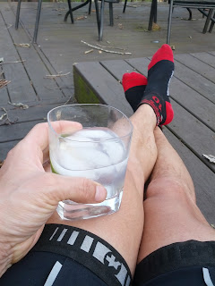
The rest of the ride back to the house took us through the Methodist camp at Orkney Springs and a well-deserved gin and tonic
and our traditional Jay-Romick-prepared paella dinner on deck.
Link to Strava:
Day 3 Saturday, April 18
After turning over the route-planning for the day to Glenn, we carefully made sure that we only took maps that contained areas that we were not planning to ride. That lead to a lot of GPS checking. The first destination was Wolf Gap. I was confused by the signage on Johnstown Rd, which indicated "Road Ends." It had been several years since I had been up this road, and was worried it the National Forest Rd had been closed. But it was open and we rolled up and over the Gap. We came back from Wardensville on FR 82, going the opposite way from 2013 and 2005(?).On this traverse of the road Bruce's friend Dennis started to fade. Before the climb back up to Judge Rye Rd we took an executive decision and sent him and Bruce down to WV253 to wait for pickup.
Judge Rye Rd was in tremendous condition--very little gravel on hard-packed clay. I flew down the descent, despite pulling my foot twice trying to bunny hop holes.
Link to Strava summary:
Day 4 Sunday April 19
Just a short roll around before everyone had to pack up and go.
Our accounting procedures (a long-tradition, always involving a piece of cardboard rescued from the trash) are worthy of a big-four firm:
$180 per person for four days of adventure.
Postscript
Less than a month after we all parted on that Sunday, we got word that Brian Thompson had died suddenly and unexpectedly.


No comments:
Post a Comment